The official website of Mid Ulster
En

Davagh Forest Walking Route

Cookstown, Co Tyrone
Davagh Forest Walking Route

Book Tickets Online

About

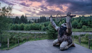
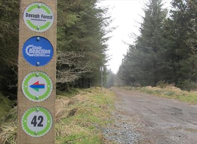
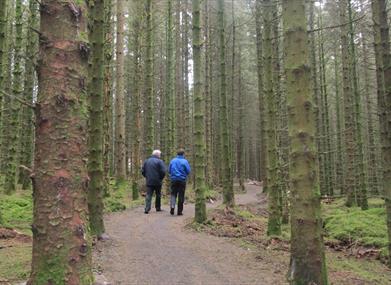
The true definition of a hidden gem, Davagh Forest lies approximately 6 miles north west of Cookstown in an untouched rural landscape of rolling hills and sweeping forests. In an attempt to unlock Davagh’s unique potential as a recreational hub, Cookstown District Council has recently launched a brand new network of walking and mountain biking trails which is set to put this forgotten forest back on the map.

Start Point:
H694862

Finish Point:
H694862

Route:
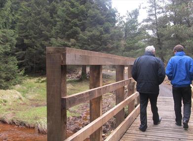
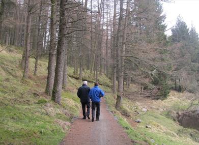
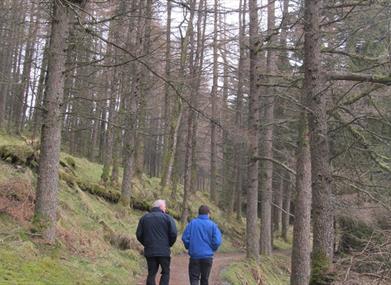
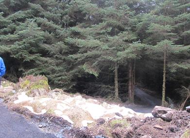
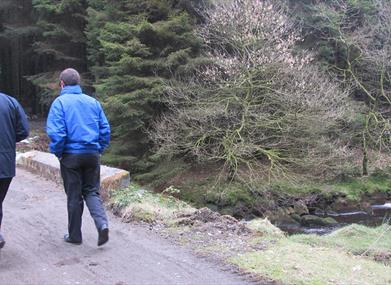
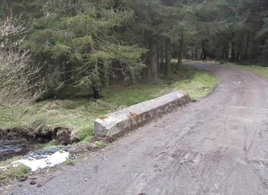
Davagh Forest’s short circular walk begins from the upper car park and follows the black waymarker arrows alongside Davagh Water. This pleasant riverside path meanders through lush green, almost fluorescent, woodland before crossing over Davagh Water and gradually ascending to meet the main forest road. Look out for the red tint of the river when crossing the newly constructed footbridge. The return leg of this walk uses the wide, surfaced forest road which leads down to meet the car park and back to the start of the trail.

Distance:
2 miles

Terrain:
forest trails with loose gravel

Point of interest:
Davagh Water, Davagh Forest

Facilities:
There is a car park and picnic facilities available at the trailhead.

Publication:
Davagh Forest Trail Card

Publication availability:
Available to purchase from www.mountainbikeni.com/trail-cards

Nearest town:
Cookstown

OS map:
13

Facilities

Provider Preferences

  • Free (parking charges may apply)

Map & Directions

What's Nearby

  1. The Giants of the Sperrins Sculpture Trail consists of three innovative, unique yet…

    0.04 miles away
  2. The true definition of a hidden gem, Davagh Forest is an International Dark Sky Park and…

    0.12 miles away
  3. A 3.4km Solar Walk linking the observed solar system in the sky with the astronomical…

    0.21 miles away
  1. Take a journey through time and space with a visitor experience that’s out of this world.…

    0.21 miles away
  2. A film projection on to the outside of the Observatory building, our OM Odyssey will take…

    0.21 miles away
  3. Mysterious complex of 7 Bronze Age stone circles and alignments. It's where megalithic…

    1.4 miles away
  4. Wellbrook is nestled in an idyllic wooded valley. As you come over the hill and see the…

    5.54 miles away
  5. The attractive eighteenth-century demesne is now a forest park. Colourful in spring and…

    6.72 miles away
  6. Lissan House is an enchanting country residence set within a 260 acre demesne of ancient…

    6.79 miles away
  7. The only theatre venue of its kind in Mid Ulster, the Burnavon Arts and Cultural Centre…

    8.61 miles away
  8. Killymoon castle sits in picturesque surroundings overlooking the Ballinderry River on…

    9.95 miles away
  9. Step back to 1912 as you experience the Lenox-Conyngham home on the morning they left to…

    10.9 miles away
  10. Tullaghoge Fort was a royal power centre which came to historical prominence in the 11th…

    10.94 miles away
  11. Nestled in a secluded area located 2.5 miles to the North West of Maghera, Tirkane is a…

    13.01 miles away
  12. One mile north of Maghera stands a prehistoric tomb at least 4,000 - 6,000 years old.…

    13.17 miles away
  13. The town of Maghera is a site of religious significance from ancient times.

    13.17 miles away
Previous Next

Related

Ceoldán, the Stargazer, kneeling on a timber boardwalkGiants of the Sperrins - The Stargazer, Northern IrelandThe Giants of the Sperrins Sculpture Trail consists of three innovative, unique yet linked artworks commissioned by Recycle Artist Thomas Dambo and installed at key locations within the Sperrins region.

Map & Directions

Road Directions

Located approximately 50 miles from Belfast, Davagh Forest is signposted off the A505 Cookstown to Omagh Road at Dunnamore. If travelling from Draperstown, take the B47 through the village of Straw before bearing left on the Sixtowns Road. Turn left on the Davagh Road signed East Sperrins Scenic Route and after 3 miles the trailhead will be on your left hand side. TRAILHEAD POSTCODE: BT79 8JH

Public Transport Directions

Translink - journeyplanner.translink.co.uk

View Maps and Visitor Guides
View what Mid Ulster has to offer and some of the best things to see and do during a visit.
E-newsletter sign up
Sign up for the Mid Ulster newsletter for inspiration and travel tips.
Back to Top

Tourism Northern Ireland

Don't Miss